Construction
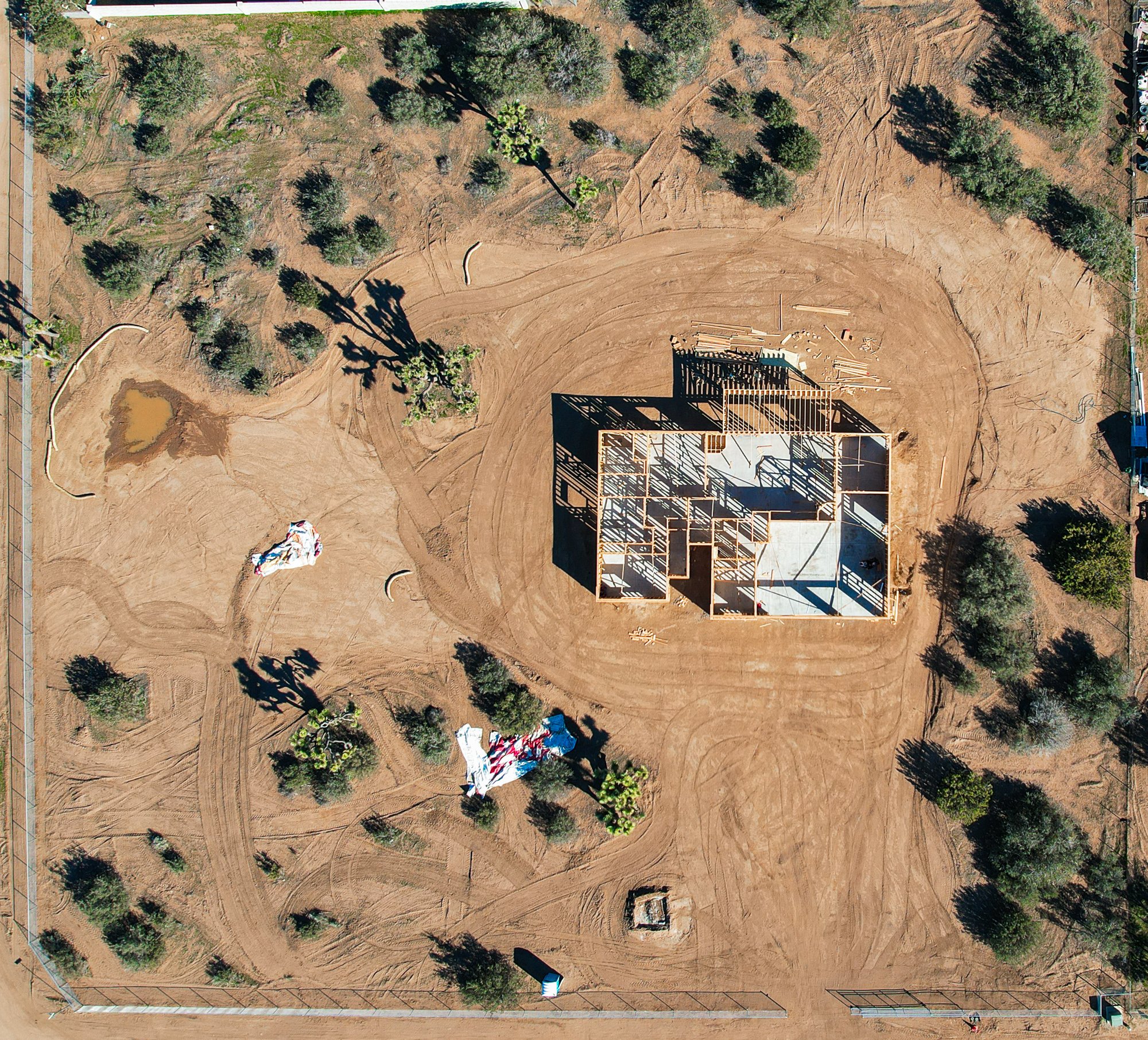
Drones have transformed the landscape of construction, offering heightened efficiency and safety. Outfitted with advanced cameras and sensors, they meticulously survey construction sites, providing real-time data on progress and potential challenges. Drones enable precise topographical mapping, facilitating accurate measurements and aiding project planning. Beyond that, drones play a pivotal role in documenting construction progress, capturing evolving stages for comprehensive project tracking. This integration not only streamlines processes and ensures accuracy but also proves cost-effective, reinforcing their indispensable role in modern construction practices.
Construction Progression
Contact for Pricing
Drone technology facilitates efficient construction site progression documentation. These aerial devices capture evolving stages with precision, offering real-time insights into project development. From initial groundwork to structural completion, drones enhance project monitoring, enabling stakeholders to make informed decisions and ensuring accurate record-keeping for streamlined construction management.
Site Modeling
Coming Soon
Drone construction site modeling involves using unmanned aerial vehicles to create accurate representations of construction projects. Drones capture detailed imagery, enabling precise modeling and comprehensive orthomosaics. This technology enhances project visualization, aids in planning, and provides valuable data for efficient decision-making throughout the construction process.
3D Modeling
Coming Soon
Move beyond conventional construction site maps with cutting-edge 3D modeling. Whether aligning progress with initial blueprints or obtaining volumetric measurements, aerial imaging and data capture elevate project insight. 3D modeling offers near real-time information, visually demonstrating a site's development and addressing current needs for investors.
Only a licensed land surveyor possesses the expertise to interpret measurement data, ensuring accuracy and compliance with regional regulations. Accessible Skies Drone Services is ready to provide all gathered data to your survey team, collaborating closely with them to fulfill specific data collection requirements.


